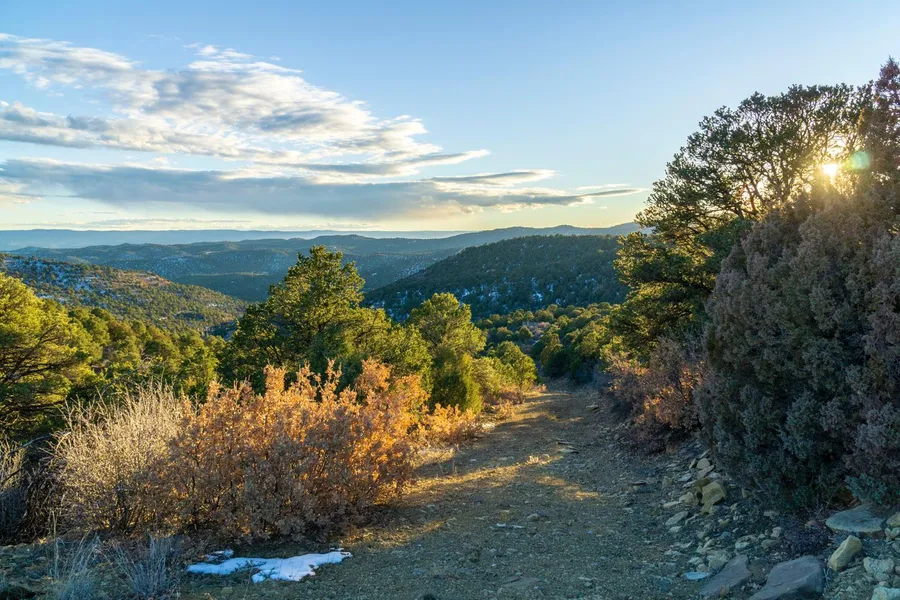
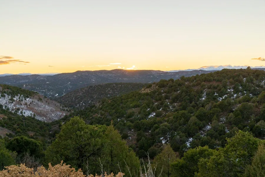
Large Ranch Rolling hills and Trees
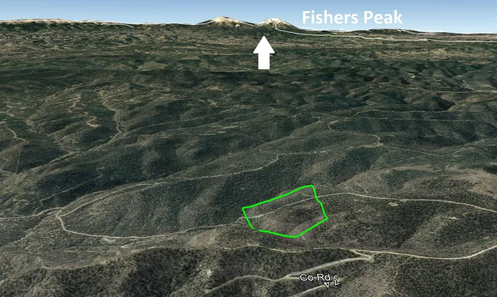
41 Acre rural land in Fishers Peak Ranch only 6 miles to I-25. The Town of Trinidad is 20 minutes away.
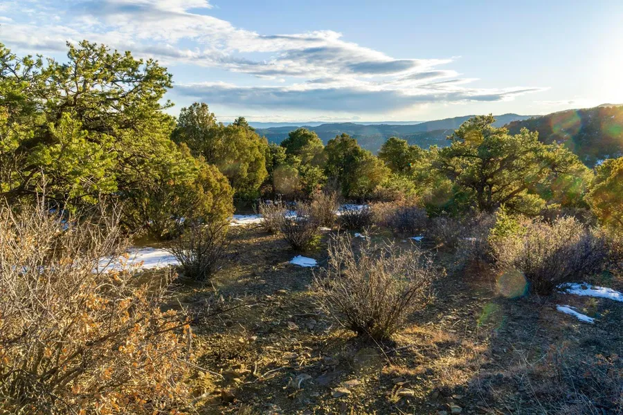
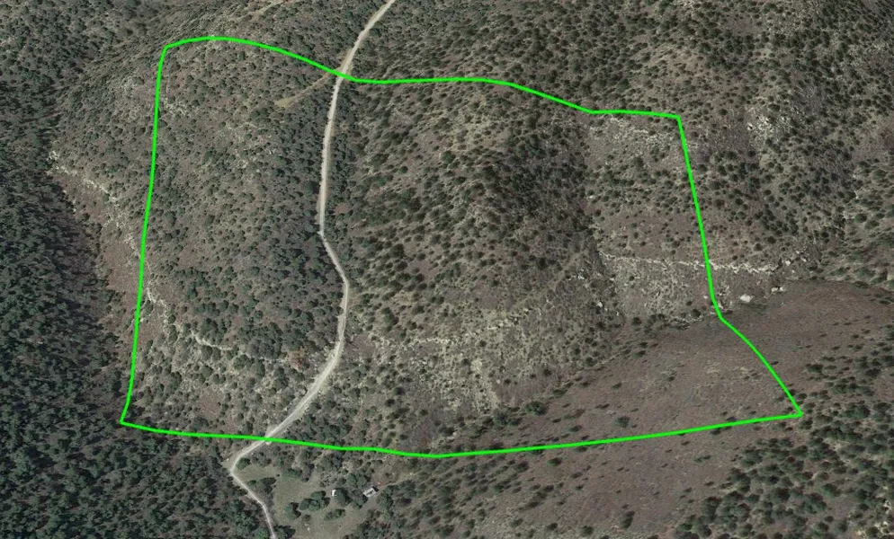
This is remotely located land but with access to the highway and town. The roads wind through the mountains offering amazing glimpses of the Colorado Mountain landscape. Fishers Peak is a gated subdivision offering total privacy. Trees are heavy on this land but with 40 acres there are several places to setup and catch some great views. Anyone owning this land could cut some glorious biking and walking trails through the hills and trees.
Several residences are nearby making a go of it but this is still a very rural area and comes with tons of privacy.
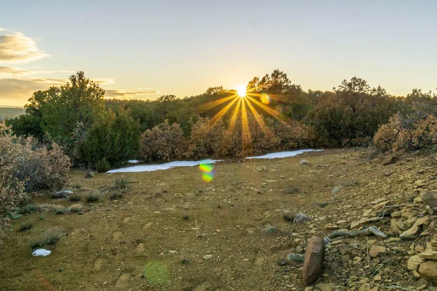
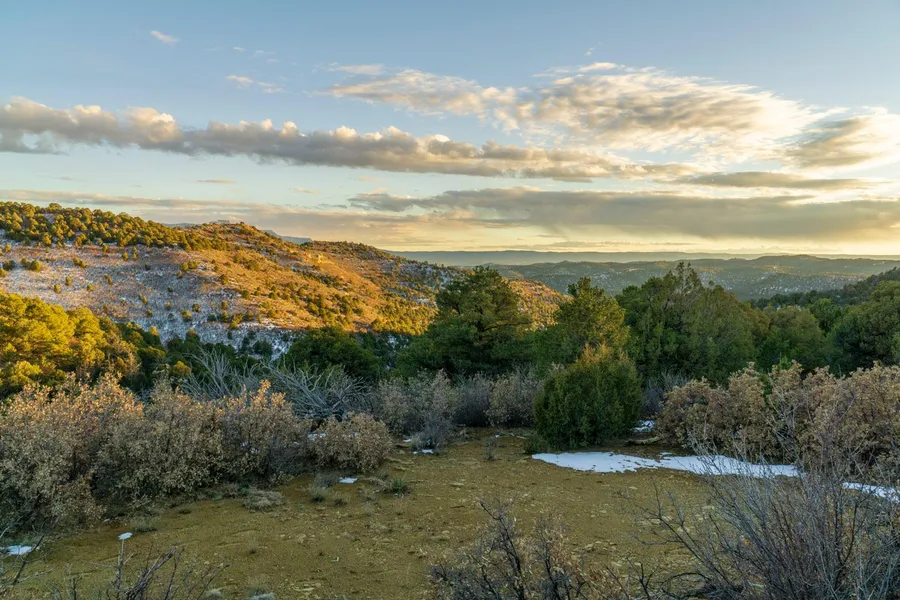
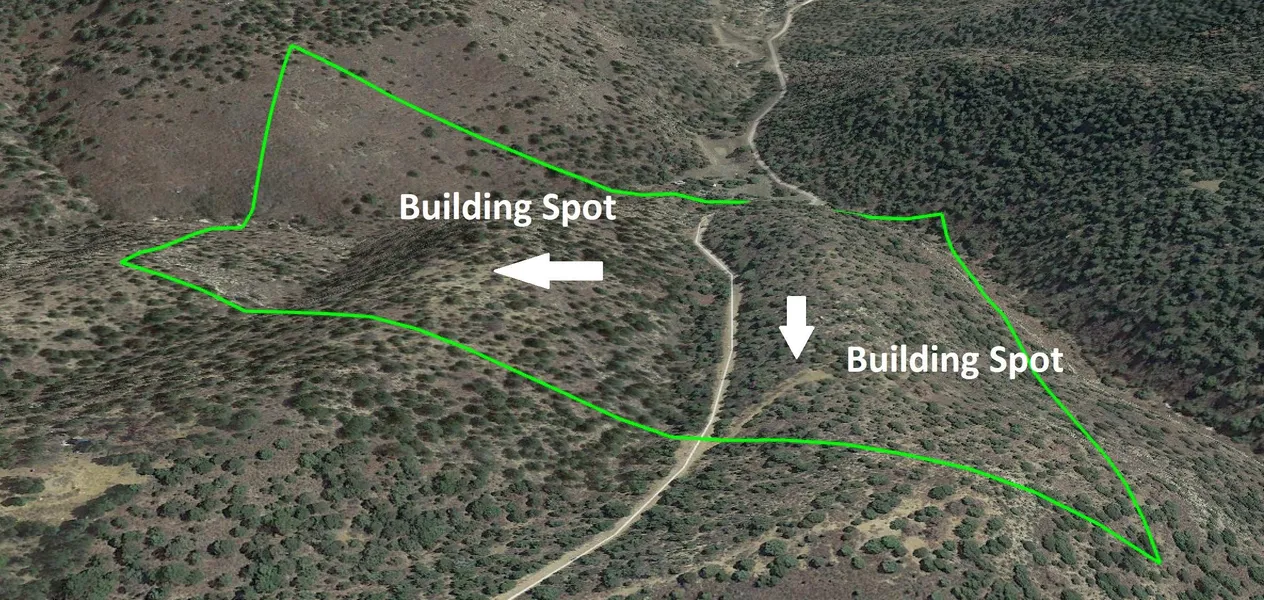
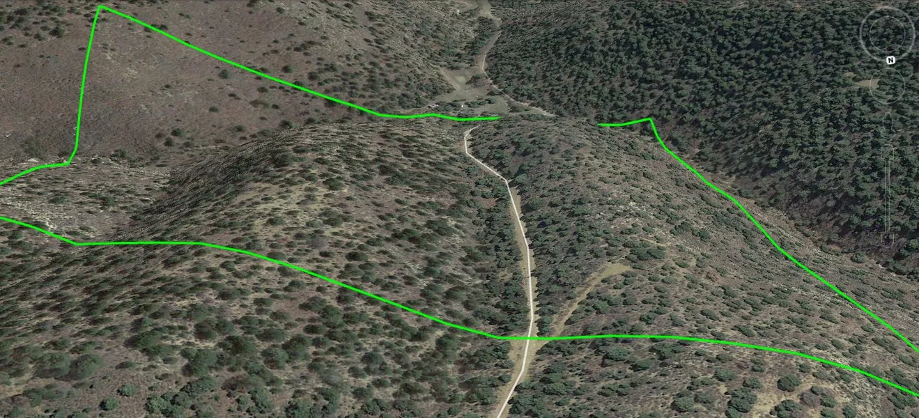
The northern portion of this land has a cutout from the road with an area to park and setup camp or plan your cabin build. The are offers spectacular views. There is another flatter portion with more sparse trees on the northern end that could be an area that is developed for possible dwelling.
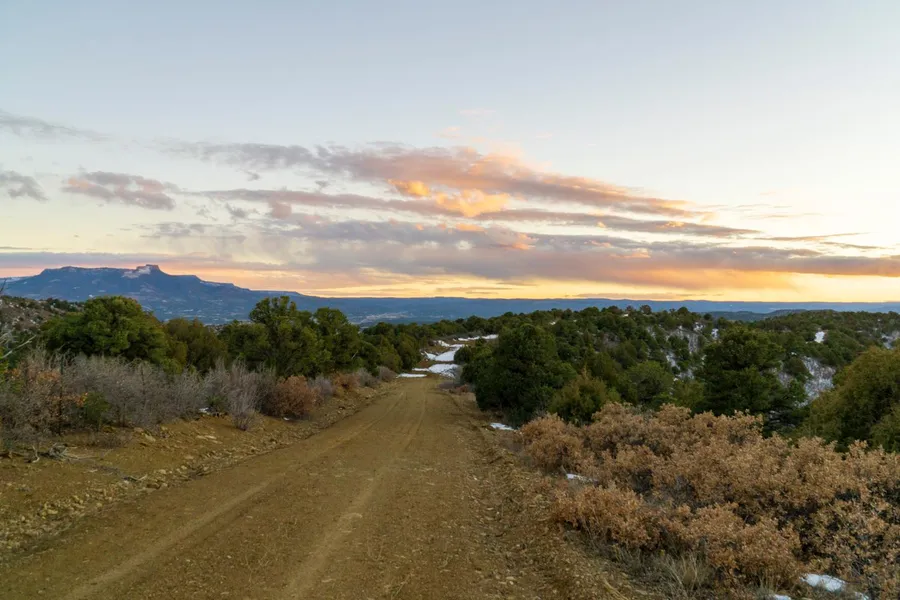
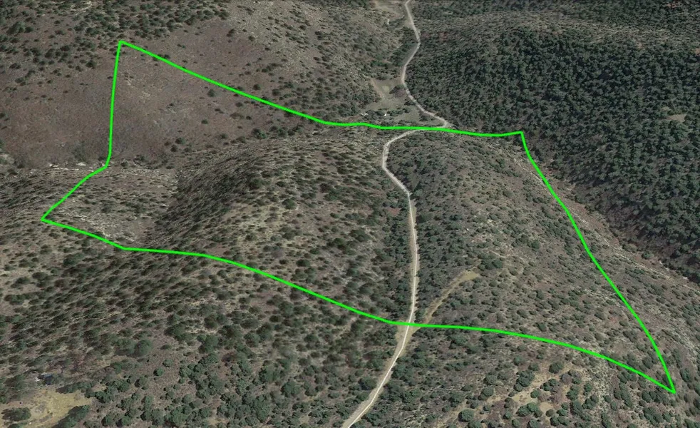
Access should be done from the northern portion of the land. The southern portion has a very rocky and steep grade. One could gate off this land to avoid an passerbys. Once a dwelling is established the Fishers Peak Ranch POA would allocate funds to help pay for road improvements in front of the land if desired.
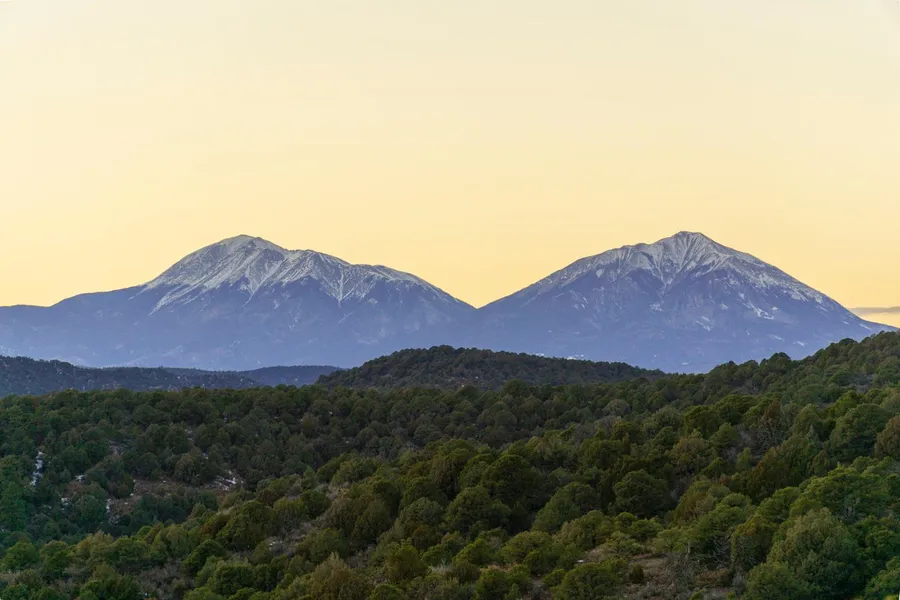
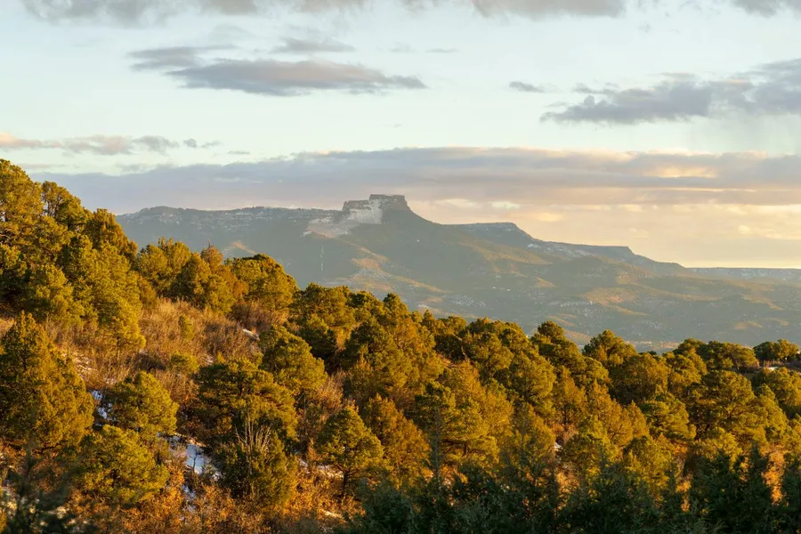
Views on clear days are extremely impressive as you can see numerous peaks and valleys all around you. The Sangre de Cristo, Silver and Greenhorn Mountains and Fishers Peak are also visible.
Recreational activities are plenty in this area. You can climb, hit the trails, fly your drone. You can also take advantage of the area national parks.
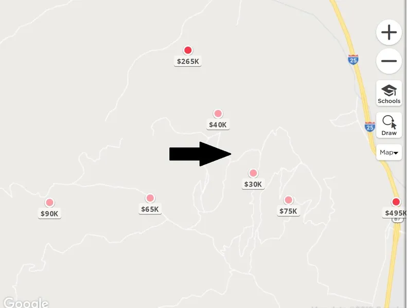
Nearby properties in Fishers Peak have sold for over $35,000 $40,000.
County: Las Animas
APN: 10428300
Legal Description: Fisher Peak Ranch Lot-n8- Cont-41.04 Acrs M/l (located In Pt-sw4-23- & Pt-nw4- 26-32-64
Size: 41 Acres
Terrain: Hilly, Lots of trees
Elevation: 6,800 ft
Access: Legal Access Gated Community Dirt Road
Approx GPS:
NW Corner
371424.87N, 1043223.16W
North Road Entry (Map to Here)
371422.87N,1043216.83W
SW Corner
371413.19N,1043223.36W
SE Corner
371410.13N,104326.47W
NE Corner
371418.99N, 104326.13W
Water: You have to dig a well
Electricity: Check with San Isabel Electric for cost to bring electric to lot
Septic: Needed if you build
Conveyance: Warranty Deed
Approximate Distance to Nearby Cities & Points of Interest
15 Minutes to I-25
20 Minutes to Trinidad
45 Minutes to Walsenburg
60 Minutes to Spanish Peaks Wildlife area
From elevation to risk assessment
Search for detailed parcel information including; Elevation & Vegetation Maps, Ownership Information, Detailed Parcel Information, Crop History Map, Soil Survey Productivity Data, and more.
Research Parcel InformationDirections
Past the gate you can opt for Northern access or southern. Southern access is a shortcut but the road entering the lot is very rocky and on a grade. Better access is to the north. Mapped image attached shows the northern and southern access.
Resources
Unlock the full Land.com experience
Have an account?Sign In
Land for Sale by Patrick Young
Las Animas County Properties By Type
- Ranches for Sale in Las Animas County, Colorado
- Undeveloped Land for Sale in Las Animas County, Colorado
- Farms for Sale in Las Animas County, Colorado
- Hunting Land for Sale in Las Animas County, Colorado
- Riverfront Property for Sale in Las Animas County, Colorado
- Recreational Property for Sale in Las Animas County, Colorado
- Residential Property for Sale in Las Animas County, Colorado
- Lakefront Property for Sale in Las Animas County, Colorado
- Commercial Property for Sale in Las Animas County, Colorado
- Horse Property for Sale in Las Animas County, Colorado
- Timberland for Sale in Las Animas County, Colorado
- Beachfront Property for Sale in Las Animas County, Colorado
Properties for Sale Nearby Counties
Las Animas County Properties By City
- Aguilar, Colorado Land for Sale
- Boncarbo, Colorado Land for Sale
- Branson, Colorado Land for Sale
- Hoehne, Colorado Land for Sale
- Kim, Colorado Land for Sale
- Model, Colorado Land for Sale
- Trinchera, Colorado Land for Sale
- Trinidad, Colorado Land for Sale
- Weston, Colorado Land for Sale
- Cokedale, Colorado Land for Sale
- Delhi, Colorado Land for Sale
- El Moro, Colorado Land for Sale
- More
- Jansen, Colorado Land for Sale
- Ludlow, Colorado Land for Sale
- Monument Park, Colorado Land for Sale
- San Miguel, Colorado Land for Sale
- Segundo, Colorado Land for Sale
- Starkville, Colorado Land for Sale
- Stonewall, Colorado Land for Sale
- Tercio, Colorado Land for Sale
- Tyrone, Colorado Land for Sale
- Vigil, Colorado Land for Sale
- Villegreen, Colorado Land for Sale
- Abeyta, Colorado Land for Sale
- Andrix, Colorado Land for Sale
- Barela, Colorado Land for Sale
- Beshoar, Colorado Land for Sale
- Cordova Plaza, Colorado Land for Sale
- Earl, Colorado Land for Sale
- Engleville, Colorado Land for Sale
- Gulnare, Colorado Land for Sale
- Houghton, Colorado Land for Sale
- Lynn, Colorado Land for Sale
- Medina Plaza, Colorado Land for Sale
- Parras Plaza, Colorado Land for Sale
- Patterson Crossing, Colorado Land for Sale
- Reilly Canyon, Colorado Land for Sale
- Rugby, Colorado Land for Sale
- Sarcillo, Colorado Land for Sale
- Sequndo, Colorado Land for Sale
- Simpson, Colorado Land for Sale
- Stonewall Gap, Colorado Land for Sale
- Tijeras, Colorado Land for Sale
- Tobe, Colorado Land for Sale
- Torres, Colorado Land for Sale
- Valdez, Colorado Land for Sale
- Vallorso, Colorado Land for Sale
- Velasquez Plaza, Colorado Land for Sale
- Walts Corner, Colorado Land for Sale
- Zamara, Colorado Land for Sale